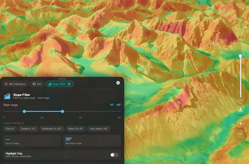
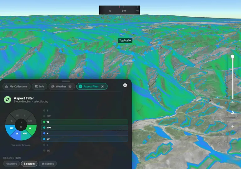
Slope Analysis
Visualise gradient across the entire terrain. Identify sections that are safe for travel or technically demanding.
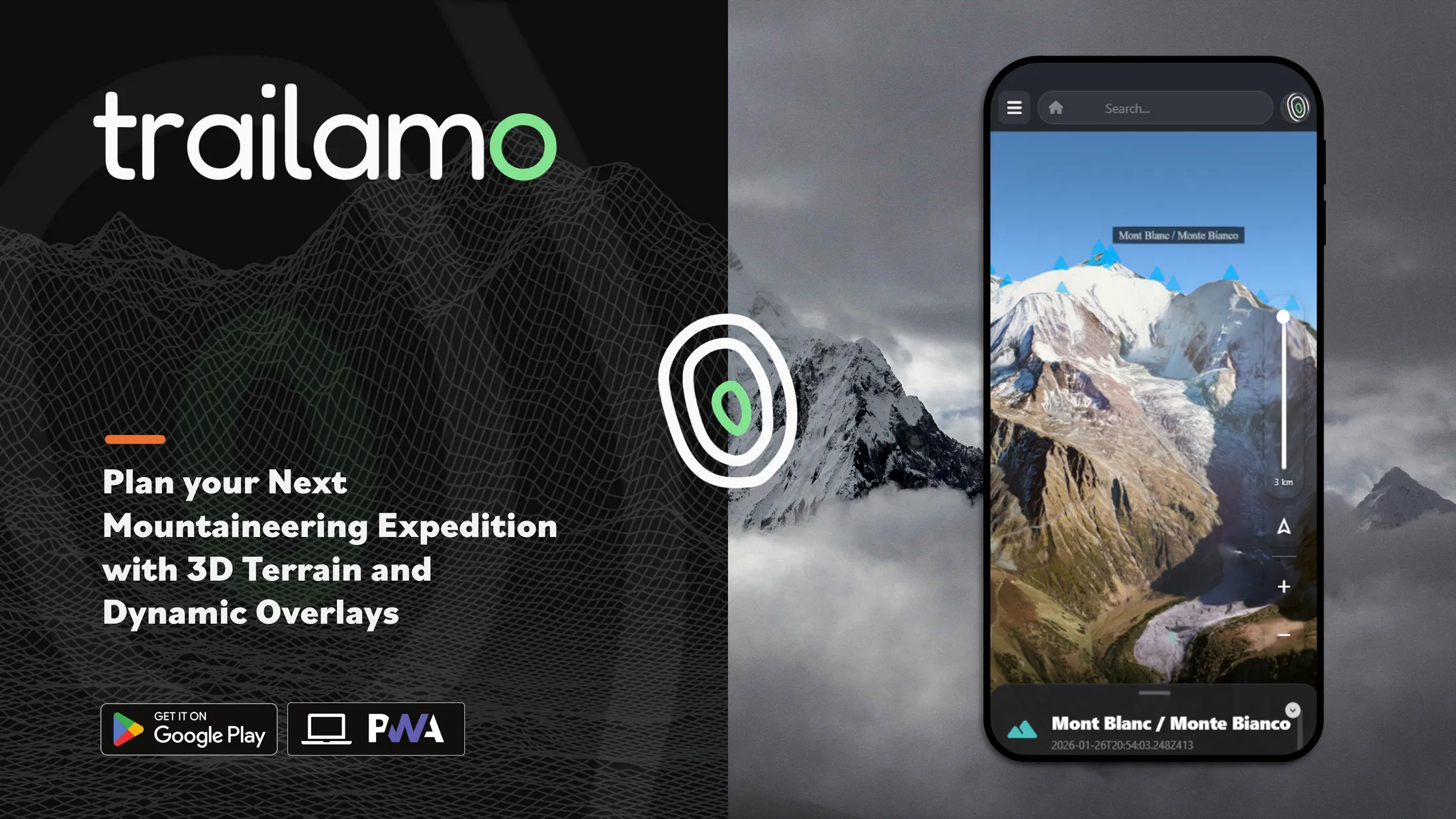
Route planning, 3D terrain analysis, and live mountain data — all in your browser.
A true multi-layer planning environment with the richest map selection available — satellite, topographic, hiking, and more.
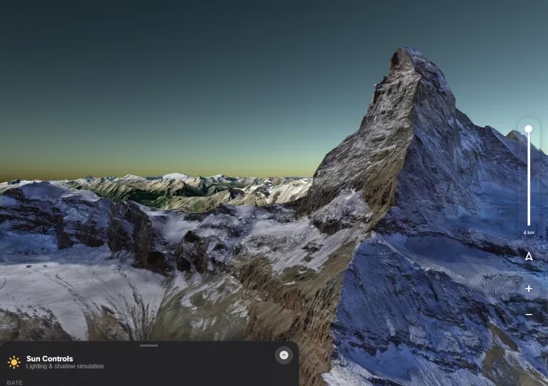
Built on Cesium's 3D globe engine, Trailamo renders every peak, valley, and ridge in full three dimensions with real altitude profiles.

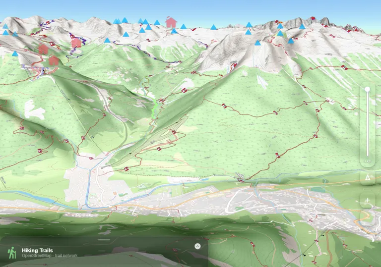
Switch between satellite, topographic, hiking, and hybrid base maps in seconds. Combine with overlays to build a complete picture of your route.
Integrates directly with MapTiler & Tracetrack for premium tile rendering for more route discovery and sharing.
Advanced terrain tools used by mountain professionals — now accessible to every hiker, ski tourer, and alpinist.

Draw routes directly on the 3D map, get instant terrain analysis, and share with your team — everything in one place before you leave the valley.
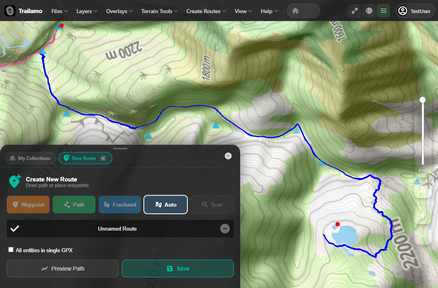
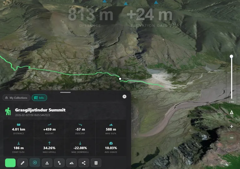
Draw freehand or snap to existing trails directly on the 3D terrain. Import GPX files from any device, or study the community routes.
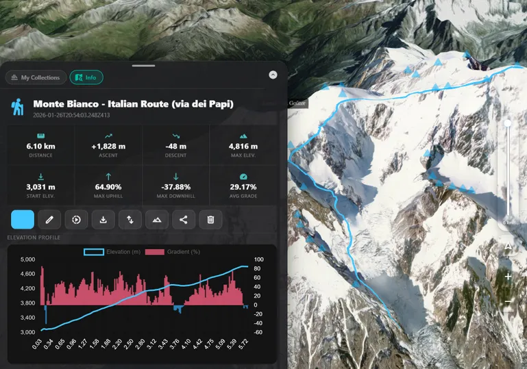
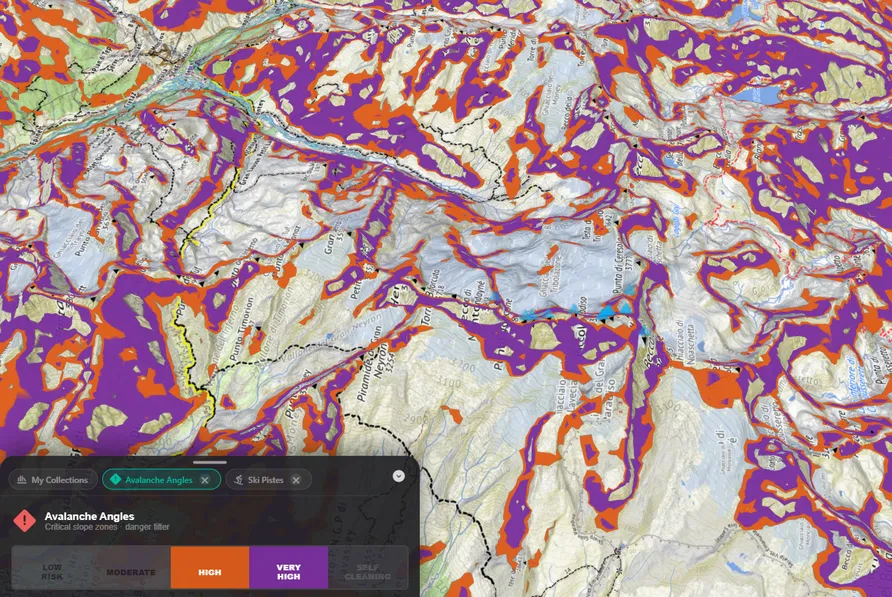
Every route is instantly analysed against the terrain. Get a full breakdown of elevation gain, slope angles, aspect exposure, and avalanche risk — before you commit.
Generate a shareable link to your full route — including all overlays, terrain analysis, and waypoints — so the whole group is aligned before the day begins.
Trailamo pulls from authoritative open data sources to overlay real-time information directly on your planning map.
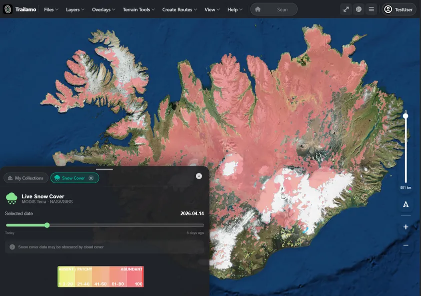
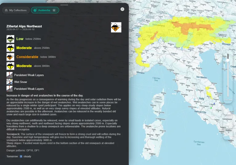
Overlay live snow depth, weather forecasts, and avalanche bulletins directly on your planning map. Make informed decisions backed by real data.

Find mountain huts, ski piste networks, and thousands of public GPS tracks from the community — all visible on the same map as your planned route.

Trailamo is a PWA — it runs in your browser but installs like a native app on any device. No app store required.
Trailamo aggregates authoritative open datasets so you always have the most accurate and up-to-date information.
Everything you need to know before you start planning with Trailamo.
Trailamo is a 3D mountain route planning app that combines terrain analysis, live mountain layers, route creation tools, and open map data — all in your browser.
Built for hikers, alpinists, ski tourers, mountain guides, clubs and outdoor teams who want better route planning and terrain awareness before going into the mountains.
Yes. Import GPX files from any device, draw routes on the 3D terrain, analyse the route, and share a planning link with your group — all in one place.
Yes. Trailamo includes live avalanche bulletins, snow depth layers and weather overlays from authoritative open data sources, directly on your planning map.
Yes. Trailamo is a Progressive Web App (PWA) — it runs in any browser and installs on iOS, Android or desktop without an app store.
Open Trailamo in your browser right now — no account required. Install as an app for the full offline experience.
Open Trailamo in your browser right now — no account required. Install as an app for the full offline experience.